Wissen
Lauberhorn: The long downhill to Wengen
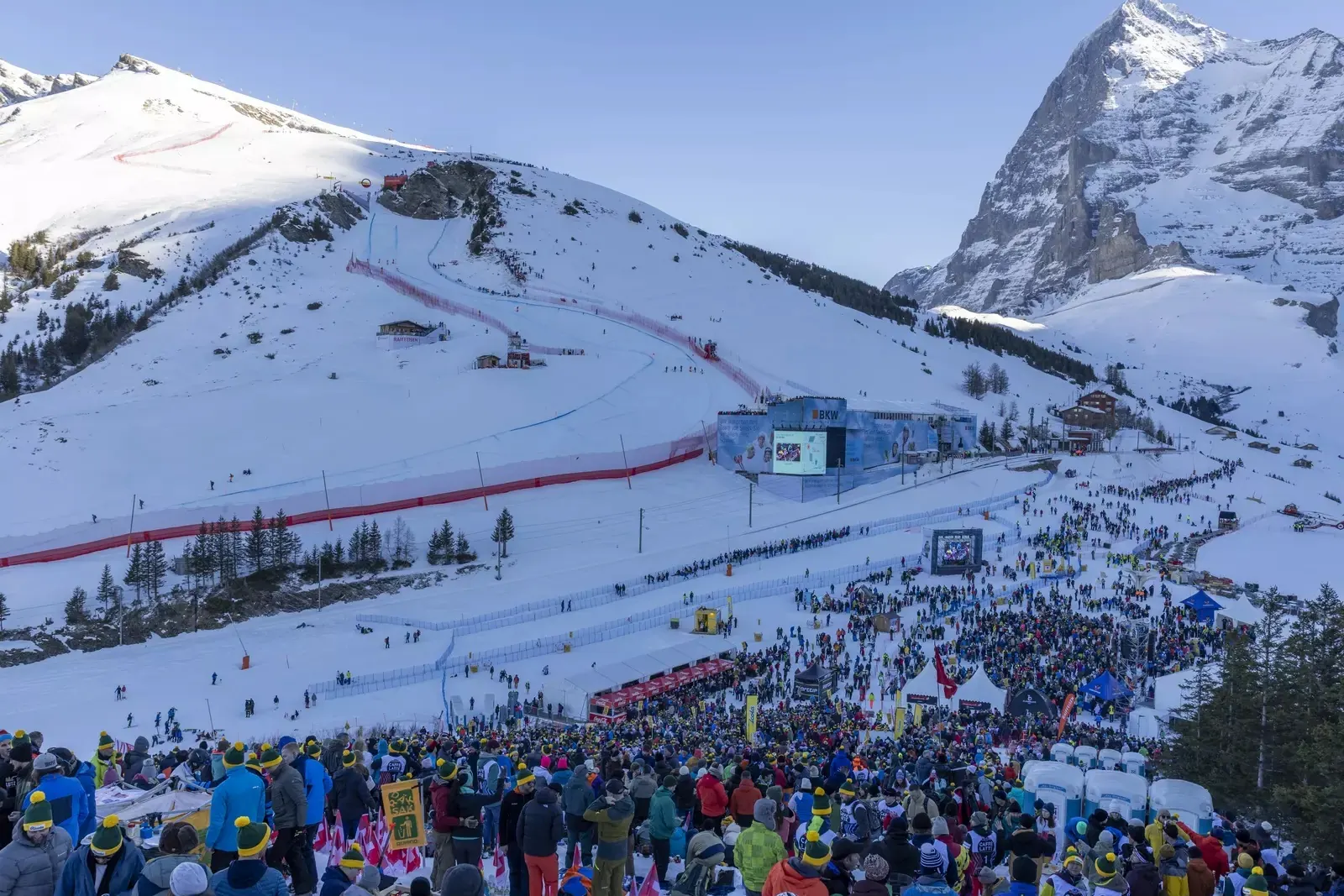
4.5 kilometres, 1,028 metres of vertical drop, 41 degrees at Hundschopf: the Lauberhorn downhill to Wengen and your places along the course.
At Lauberhorn, length is part of the character. Between the open shoulder at the start and the finish in Innerwengen lie gliding sections, jumps and narrow passages. You see a downhill that repeatedly changes its demands. Hundschopf is its best-known image. It does not tell the whole story.
For a visit, it helps to read the course as a route through the landscape. The race passes rocks, railway tracks and forest before reaching the bottom. Your route as a spectator follows a different order: the ticket area and railway connections determine which section you can actually reach. We recommend making this decision before looking for accommodation.
The railway is also part of the course setting. At Wasserstation, the racecourse and railway tracks cross in space, while spectators need different connections for their journey. Keep these two maps separate. A railway in the background of a race photo does not yet tell you at which station to get off for exactly this view.
The long line to Innerwengen
- 01
Start on the Lauberhorn shoulder: 2,315 metres.
- 02
Course length according to the organiser: 4.5 kilometres.
- 03
Vertical drop according to the organiser: 1,028 metres.
- 04
Steepest section at Hundschopf: 41 degrees.
From the open start to the narrow passage
The start is on the Lauberhorn shoulder. After the Russi jump, the course gathers speed through the traverse before its character changes at Hundschopf. In the rock passage, the line has to be very precise. The fact that the steepest section is given in degrees is important for comparisons: degrees and percentages refer to different measurements.
The official course description also explains how the Russi jump came about. Bernhard Russi had a jump built for television footage; the race officials later incorporated it into the course. Stories like this make the downhill tangible. A modern course name can originate from a specific decision and then remain in use for many races.
For watching, we recommend looking at the sequence of these sections in advance. A spot at Hundschopf shows the passage and the movement over the edge. You cannot automatically follow the long acceleration beforehand from there. Images from different camera positions only come together to create the familiar televised view of the course.
Kernen-S, Wasserstation and the route into the valley
After Hundschopf, the course remains varied. Kernen-S requires a change of direction in a confined space. Wasserstation passes underneath the railway. It is a good example of how closely this downhill is tied to its surroundings: the racecourse uses an existing passage and has to align its line with it.
The organiser describes further fast and technically demanding sections up to the finish. So simply focusing on top speed is not enough when watching. A good exit from a turn can have a lasting effect on the following gliding section. You can best recognise the connection by consciously comparing the entry and exit of a passage.
This is our recommendation for a visit to the mountain: choose an accessible spot whose terrain interests you and stay with the same observation over several runs. Following the whole race in parallel on a screen can help. However, you should check any advertised video wall in the plan for the specific spectator area.
A race with its own landscape since 1930
The Lauberhorn races date back to Ernst Gertsch and the year 1930. They have been part of the series since the first World Cup year in 1967. The verified local editorial team describes this development as part of Wengen’s history. This makes the village more than a destination name in the calendar: the racecourse connects the village with the terrain above it.
The downhill follows a different route from the slalom. Nor should the super-G simply be equated with the same starting position and the same line. When comparing figures, therefore, pay attention to which discipline is meant. The figures in the key facts box refer to the downhill in the published organiser’s description.
For us, the particular appeal lies in the alternation between open space and narrow sections. Anyone who mainly wants to see closely spaced gate changes may prefer the slalom. Watching the long downhill requires patience for the parts outside your field of vision. You should choose this trade-off consciously.
Choose Innerwengen or Wengernalp
For the finish arena, the organiser describes the route via Lauterbrunnen to Wengen and from there on foot to Innerwengen. For Wengernalp and Girmschbiel, it gives a different route via Grindelwald Terminal, Eigergletscher and Kleine Scheidegg. Follow the route for your ticket. The two visits already differ from the start of the journey.
According to visitor information, the start area requires snow sports equipment and a ski pass for the Lauberhorn chairlift. This is a decisive limitation for a group that includes pedestrians. Arrange your meeting point so that everyone can reach it via an authorised route. A group photo together at the start is not a workable plan if some of the group cannot get there.
Start looking for accommodation by making one decision: should the daily journey to the ski area or to your viewing spot be short? For a visit to the finish, check the walking route from Wengen; for a mountain spot, first check the confirmed railway route.
Sources
- Downhill, key figures and course stations, Lauberhorn organiser, accessed 22 October 2026 (in German) ↗
- FAQ with access to the finish, Wengernalp and the start, Lauberhorn organiser, accessed 22 October 2026 (in German) ↗
- Wengen and getting there, Jungfrau Region Tourismus, accessed 22 October 2026 (in German) ↗
Inspiration, knowledge and gear for people who want more from the outdoors.